The 38 Best Anchorages in MARLOG's Atlas
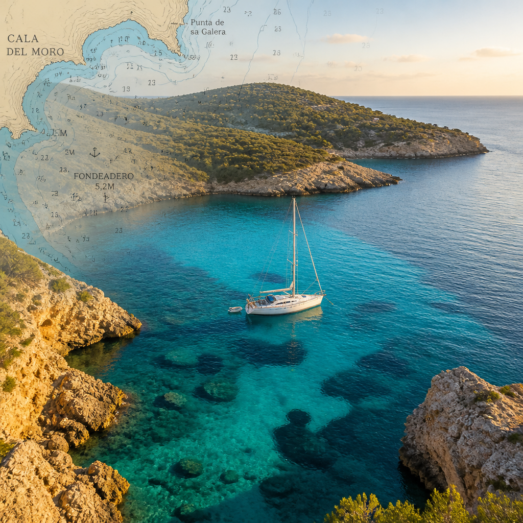
Finding a truly sheltered anchorage is the difference between a restorative night at anchor and a sleepless, white-knuckle vigil on watch. Most sailors know three or four reliable spots in their home cruising ground. The best anchorages worldwide number far more than that, and tracking them down by piecing together cruising guides, paper charts, and word-of-mouth is a slow and unreliable process. MARLOG's atlas of 1,160 charted maritime places solves this directly: every entry is selected for navigational value, not just scenic appeal. This guide highlights 38 of the standout entries, explains what makes each one genuinely worth your anchor chain, and shows you how to use the app to plan passages to them with real-time weather and tidal context built in.
What Makes a Best Anchorage
A best anchorage is not just a pretty bay. It earns that label by meeting at least four criteria: reliable all-weather protection from the dominant swell and wind direction, a holding ground that your anchor can grip, room to swing without fouling a neighbor, and a safe entrance that does not punish you for arriving in reduced visibility or at night. Scenic bonus points are real, but they never substitute for protection and holding.
MARLOG's atlas applies exactly this logic. Each of the 1,160 charted places carries contextual data about approach bearings, depth, bottom composition, and weather exposure windows. The anchorage app layers real-time Copernicus marine model data and Apple Weather forecasting on top of each location, so you assess a bay not just in the abstract but against tomorrow's actual wind and swell forecast before you commit your passage plan.
The 38 entries highlighted here come from every major ocean basin covered in the atlas. They represent a mix of globally famous anchorages that live up to their reputation and genuinely underrated spots that most passage-planning tools miss entirely.
Quick Takeaways
- Protection beats scenery every time: The best anchorages in MARLOG's atlas are ranked by shelter quality, holding ground, and safe approach, not by Instagram appeal.
- Bottom composition is the deciding factor: Sand over clay holds in 30 knots. Weed over rock does not. Always check the bottom type before you set the hook.
- Real-time forecasting changes passage decisions: MARLOG integrates Copernicus marine models directly into its atlas, so you see a sailing window forecast for each anchorage, not just a static chart note.
- 1,160 charted places covers every major ocean basin: The atlas spans the Mediterranean, Atlantic, Caribbean, Pacific, and Indian Ocean, removing the need to cross-reference multiple regional pilot books.
- Night arrivals demand pre-planned waypoints: The best-prepared sailors pre-load approach waypoints for every intended anchorage before departure, using MARLOG's route planning tools at the dock.
- Swing room is a calculation, not a guess: At the right scope on a calm day, your anchor circle can cover 50 metres of radius. Calculate it against your neighbors before you drop the hook.
- Seamanship knowledge closes the gap: MARLOG's 16 built-in seamanship courses cover anchoring technique, tidal planning, and COLREGS, which means the atlas is paired with the skills to use it correctly.
Mediterranean and Aegean Highlights
The Mediterranean concentrates more high-quality anchorages per nautical mile than any other cruising ground on the planet. Limestone headlands, volcanic caldera bays, and drowned river valleys create a diversity of shelter that rewards sailors who know where to look. MARLOG's atlas captures fourteen distinct anchorage entries across this region, and the following represent the standouts.
Greek Cyclades: Small Islands, Maximum Shelter. The Lesser Cyclades chain south of Naxos, covering Iraklia, Schinoussa, and Koufonisia, punches far above its size for anchorage quality. The bay at Iraklia's eastern side offers excellent holding in sand and protection from the Meltemi, the notorious northerly that dominates Aegean summer sailing. The Meltemi runs hard and can build seas quickly in open water, but these small island anchorages interrupt its fetch and give you a genuinely calm night.
Milos, further southwest in the Cyclades group, adds Ormos Milou, a large bay formed by ancient volcanic activity. The holding there is mixed, with mud and weed patches, so you must drag-test your anchor before going below for dinner. MARLOG's atlas marks the superior holding zones within the bay rather than treating the entire anchorage as uniform. That granularity is the feature that separates a purpose-built coastal anchorage guide from a generic chart.
Turkish Aegean Coast: Gulfs and Coves. The Turkish Aegean offers an almost embarrassing wealth of anchorages in the gulfs of Göcek, Gökova, and Hisarönü. Göcek Bay in particular contains a collection of named coves, each with different wind exposure profiles. The deep inlet structure means that even when a thermal afternoon wind develops, you find a sheltered corner by moving only a mile or two. MARLOG's atlas entries for this area include approach track notes that account for the shallow bars at the mouth of some coves.
Pro tip: In the Aegean, always check your MARLOG sailing window for the next morning before anchoring. The Meltemi often peaks at Force 5 to 6 by afternoon, then eases overnight, making a 0500 departure ideal. Set a forecast alarm the night before through the app's real-time marine forecasting module.
Croatia: Kornati Archipelago and Dalmatian Channels. The Kornati National Park contains over 100 mostly uninhabited islands. The anchorages here are technically straightforward but navigationally demanding because of the number of unmarked reefs. MARLOG's atlas marks the clean approach lines to the best Kornati anchorages, including the sheltered bays on the eastern lee of the main island chain where the prevailing Bora and Jugo winds leave you undisturbed.
Atlantic and North European Waters
The Atlantic and the waters north and west of continental Europe demand a different approach to anchorage planning. Tidal range here is not a navigational footnote. In parts of the UK, France, and Portugal it is the primary factor governing whether you can reach a bay at all, how much scope to lay, and when you must leave. MARLOG integrates tidal data with its anchorage entries, so these decisions are informed rather than estimated.
The Azores: Transatlantic Stopover Anchorages. The Azores sit at the intersection of the North Atlantic trade wind belt and the westerly storm track, which makes them simultaneously one of the most frequently visited transatlantic stops and one of the most weather-dependent landfalls in the ocean. Flores and Faial offer the best anchorage options, with caldeira-sheltered bays that can handle most swell directions except direct northwesterlies. Sailors making the ARC rally or any eastward return passage use these anchorages as a genuine rest stop rather than just a fuel and water point.
The challenge in the Azores is that shelter windows open and close with approaching Atlantic fronts. MARLOG's sailing window forecasts, powered by Copernicus marine model data, give you a 72-hour view of which anchorages are viable and which are untenable at any given time.
Brittany and the French Atlantic Coast. Brittany's anchorages require competence in tidal calculation above almost any other sailing skill. The Rade de Brest, the Golfe du Morbihan, and the Glenan archipelago each contain world-class anchorages that are only accessible at specific tide heights. The Glenan islands in particular offer white-sand anchorages in turquoise water that feel subtropical and yet require you to arrive within a two-hour tidal window to avoid the surrounding drying rocks.
MARLOG's atlas entries for French Atlantic anchorages carry tidal context alongside the standard depth and bearing data. This is the practical difference between an atlas designed by sailors and a generic location database.
Scottish West Coast and the Hebrides. The west coast of Scotland and the Inner and Outer Hebrides contain some of the most dramatic, isolated anchorages in European waters. Sea lochs cut deep into the highland landscape, offering shelter so complete that you can anchor in a full Atlantic gale with almost no motion on the boat. The challenge is the weather itself: frontal systems arrive with little warning and visibility can drop to a few hundred metres. Pre-loaded approach waypoints for your intended anchorage are not optional in these waters.
Caribbean and Central American Coast
Caribbean anchorages are defined by the trade winds. The northeast trades blow at Force 4 to 5 from November through April, creating a predictable pattern: the windward sides of islands are rough and exposed; the leeward sides are calm, sometimes glassy. Every good Caribbean anchorage is therefore on a western or southwestern shore, sheltered from the trade wind swell.
Lesser Antilles: Island-Hopping Anchorages. The arc of islands from Anguilla to Grenada contains the densest concentration of well-protected leeward anchorages in the Atlantic basin. The Tobago Cays in the Grenadines set the standard: a series of small sandy islands protected by a barrier reef that kills the swell while the trade wind keeps the air cool and the mosquitoes away. Holding is excellent in sand at moderate depths of 4 to 8 metres. MARLOG's atlas entry for the Tobago Cays includes approach waypoints around the reef line, which is critical for first-time visitors arriving in afternoon sun when the glare makes eyeball navigation unreliable.
The Saintes islands south of Guadeloupe offer a comparable quality experience with a French village ashore and a dramatic double-bay layout that gives you options depending on wind direction. The holding in both bays is good sand.
Central American Pacific Coast. Panama's Pacific coast anchorages near the Las Perlas archipelago and the Darien coast are frequently overlooked by sailors focused on the Caribbean side. The Las Perlas islands offer protected overnight anchorages that work well as staging points for southbound passages. The fishing is exceptional and the anchorages are seldom crowded, making them among the most rewarding entries in MARLOG's Central American section of the atlas.
Pacific Coast and Oceania
The Pacific presents a passage-planning challenge unlike any other ocean. Distances between anchorages are measured in hundreds rather than tens of miles, and the consequences of arriving at a marginal anchorage after a week at sea are severe. The MARLOG atlas entries for the Pacific carry detailed sea state and swell direction notes for each approach, because a bay that looks sheltered on a chart can hold a dangerous beam swell from a thousand miles away.
New Zealand: Marlborough Sounds and Northland. The Marlborough Sounds in New Zealand's South Island contain a labyrinth of drowned valleys offering anchorages in almost any wind direction. Queen Charlotte Sound and Pelorus Sound each contain dozens of named anchorages with mud bottoms and good holding. The challenge here is the violent williwaws that funnel down the valleys in strong frontal conditions. MARLOG's sailing window function gives you clear guidance on which forecast conditions make Sound sailing comfortable and which call for staying in a marina.
Northland's east coast, including the Bay of Islands, offers a completely different character: warm subtropical water, white sand, and holding in 3 to 6 metres over mixed sand and mud. The Bay of Islands alone contains over 140 charted anchorages, and selecting the right one for tonight's forecast is exactly the kind of decision MARLOG's integrated weather and atlas are built to support.
Pacific Northwest: British Columbia and Southeast Alaska. The cruising grounds of British Columbia and Southeast Alaska contain some of the world's most spectacular fiord anchorages. Desolation Sound, north of Vancouver Island, is the standout: warm summer water temperatures, complete protection, and depths in many bays that go from 40 metres to 10 metres in a short distance, allowing you to anchor deep in the inlets away from commercial traffic. The wilderness character of this cruising ground makes reliable chart data and pre-loaded approach waypoints essential.
Pro tip: In British Columbia's inlets, back your anchor with a long stern line to a tree ashore. The holding ground is often soft mud over glacial sediment, and the combination of anchor and shoreline tie gives you positive position control that scope alone does not provide. MARLOG's route planning and AI compass can help you identify the best approach vectors before you leave the dock.
French Polynesia and the South Pacific Islands. The coral atolls of French Polynesia, Tonga, and Fiji contain some of the most technically demanding anchorages in the world. Pass navigation through atoll reef entrances requires precise waypoint placement and a clear weather window to avoid conflicting current and swell. Inside the lagoons, depths can vary dramatically over short distances and coral heads require anchoring with particular care. MARLOG's atlas carries specific approach notes for atoll pass entries in this region, which is information not readily available in standard chart plotter databases.
Indian Ocean and Red Sea Passages
Indian Ocean passages, particularly on the classic Blue Water Route between South Africa, Madagascar, and the Red Sea, involve anchorage decisions governed entirely by the monsoon seasons. Sail at the wrong time and the anchorages that look inviting on the atlas become untenable. Sail in season and you find a succession of sheltered, beautiful stops. MARLOG's seasonal weather overlays make this timing decision explicit rather than leaving it to the sailor's memory of which month the southwest monsoon peaks.
Red Sea: Reef Anchorages and Egyptian Coast. The Red Sea's Egyptian coast between Hurghada and the Suez Canal contains an extensive series of reef anchorages on the offshore coral banks. These are genuinely spectacular anchorages, with clear water, excellent holding in sand pockets between coral heads, and protection from the prevailing NNW winds when anchored in the correct position relative to the reef structure. They are also technically demanding: entry requires good visibility, careful pilotage, and ideally a crew member at the bow calling depths.
MARLOG's atlas entries for Red Sea reef anchorages include the critical bearing and depth profile information for reef entry. Combined with the app's AI compass and COLREGS navigation module, this gives a complete picture for passage planning along one of the world's most navigationally complex coastal routes.
The anchor is not your last resort. It is your primary tool for safety management at sea. Every anchorage decision is a navigation decision, and it demands the same precision as any other element of seamanship.
How MARLOG Scores and Presents Anchorages
Understanding how MARLOG structures its 1,160-entry atlas helps you use it faster and with more confidence. Each maritime place entry combines four information layers: the static chart data on position, depth, and bottom type; the dynamic forecast layer from Copernicus marine models and Apple Weather; the passage planning layer that generates approach routes via the AI compass; and the seamanship context layer that links the anchorage to relevant courses in the 16-module academy.
This integration is the practical advantage over using a sheltered anchorages atlas that is nothing more than a list of GPS coordinates. When you open an anchorage entry in MARLOG and see a red sailing window for the next 48 hours, you know to plan an alternative before you depart. When you see a green window that closes at hour 36, you know you have a departure deadline. This is decision-relevant information, not reference information.
Anchorage Categories Within the Atlas. MARLOG classifies its atlas entries into several operational categories: open roadstead anchorages that require a stable settled weather forecast; semi-enclosed bays that tolerate a wider range of conditions; enclosed natural harbors that work in almost any weather; and marina and port facilities that form the support infrastructure around a cruising ground. Knowing which category your intended overnight stop falls into determines how aggressively you should monitor the forecast in the preceding 24 hours.
Using the AI Compass for Anchorage Route Planning. The AI compass in MARLOG is directly connected to the atlas. When you select a destination anchorage, the AI compass generates a route that accounts for navigational hazards, recommended approach bearings, and COLREGS-compliant traffic separation considerations. For congested coastal waters like the English Channel or the Strait of Gibraltar, this capability is not a convenience feature. It is a safety tool.
Anchorage Comparison by Approach Type
Not all anchorages demand the same level of approach preparation. The table below categorizes the three main types of anchorage found in MARLOG's atlas, with representative examples and the specific planning steps each type requires.
- Open roadstead (good weather only): Representative Examples: Azores outer anchorages, Red Sea offshore reef anchorages, Las Perlas Pacific Pacific islands; Key Planning Steps in MARLOG: Check 72-hour Copernicus swell model, set a sailing window alert, pre-load alternate enclosed anchorage waypoints.
- Semi-enclosed bay (tolerates moderate conditions): Representative Examples: Tobago Cays Grenadines, Bay of Islands NZ, Cyclades cove anchorages, Marlborough Sounds inlets; Key Planning Steps in MARLOG: Check wind direction against bay opening, confirm bottom type in atlas entry, calculate swing radius against nearest neighbor.
- Enclosed harbor or sea loch (all-weather capable): Representative Examples: Scottish Hebrides sea lochs, BC fiord inlets, Göcek deep coves, Kornati National Park inner bays; Key Planning Steps in MARLOG: Use AI compass to generate approach route, check depth profile at atlas entry, verify no williwaw or katabatic wind risk in forecast.
Frequently Asked Questions
How many anchorages does MARLOG's atlas actually include? MARLOG's atlas covers 1,160 charted maritime places worldwide. These include anchorages, marinas, ports, and coastal waypoints across the Mediterranean, Atlantic, Caribbean, Pacific, and Indian Ocean sailing regions. The atlas is integrated directly into the app's passage planning and forecasting tools, not just a static list of coordinates.
What information does MARLOG give you about each anchorage? Each atlas entry combines static navigational data, including depth, bottom composition, and approach bearing, with dynamic real-time marine forecast data from Copernicus models and Apple Weather. The entry also links to MARLOG's AI compass for route generation and to relevant seamanship academy content, so you see not just where the anchorage is but whether conditions support going there and what skills apply to the approach.
How do you choose between two nearby anchorages for overnight? The decision comes down to three factors in priority order: wind direction tonight and through to 0600 tomorrow, bottom type and holding quality, and swing room relative to other boats. MARLOG's sailing window forecasts tell you whether the wind will back or veer overnight, which often changes the preferred anchorage from one bay to the adjacent one. Check the forecast first, then the bottom type, then plan your approach using the AI compass.
Is the MARLOG atlas useful for day sailing or only offshore passage planning? The atlas works at every scale. Day sailors use it to find new lunch stops and overnight anchorages within their home cruising ground. Offshore passage planners use it to string together sequences of anchorages across an ocean basin, with forecast windows evaluated for each stop. The seamanship academy content is equally relevant for both: anchoring technique, tidal awareness, and collision avoidance apply whether you are 5 miles or 500 miles offshore.
What makes a Caribbean anchorage different to plan compared to a Mediterranean one? Caribbean anchorages are driven by the trade wind direction, which is consistent but strong. You almost always want the leeward side of an island, and swell wrapping around headlands is your primary risk. Mediterranean anchorages are complicated by the variety of wind systems, including the Meltemi, Mistral, Bora, and Sirocco, each of which hits a bay from a different quadrant. Planning in the Mediterranean requires you to understand which specific wind system is forecast, not just wind speed. MARLOG's region-specific forecasting handles this distinction.
Can MARLOG help with anchoring technique as well as anchorage selection? Yes. MARLOG's seamanship academy includes dedicated content on anchoring technique, including scope calculation, drag testing, mooring in tidal streams, and med mooring. The 288 practice exercises in the academy cover scenarios drawn from real anchoring situations, making it a practical training tool rather than a theoretical one. The combination of the atlas for location selection and the academy for technique execution is what makes MARLOG a complete anchorage app rather than just a chart planner.
How does MARLOG differ from using a standard chart plotter for anchorage planning? A standard chart plotter shows you depth and chart data. MARLOG adds four elements that chart plotters do not integrate natively: real-time marine weather forecasts with sailing window assessment, an AI compass for COLREGS-aware route planning, a curated atlas with qualitative anchorage data, and an onboard seamanship academy. For sailors who want a single instrument that covers navigation, weather, planning, and skill-building, MARLOG is specifically designed to fill that role on iOS.
Have you used MARLOG's atlas to discover an anchorage you would not have found any other way? Share your experience in the comments below.
References
- Expert review of leading marine navigation apps and their anchorage features
- Practical sailing guide to anchorages across the Greek Cyclades islands
- First-hand cruising notes on Cyclades anchorages, holding ground, and approach routes
- Nautical chart resources for Mediterranean and Pacific Northwest sailing regions